


It has become increasingly evident that certain Western-dominated international bodies are displaying a troubling pattern of misrepresentation when it comes to India’s territorial integrity. The United Nations, an institution whose foundational charter emphasizes the protection of sovereignty and territorial boundaries, has repeatedly come under fire for what many perceive as cartographic bias, particularly benefiting strategic rivals like China.
A recent controversy arose from a UNDP map which excluded Jammu & Kashmir and Arunachal Pradesh from Indian territory. This sparked widespread backlash for what is being described as another act of “cartographic aggression” a consistent trend, rather than an isolated mistake.
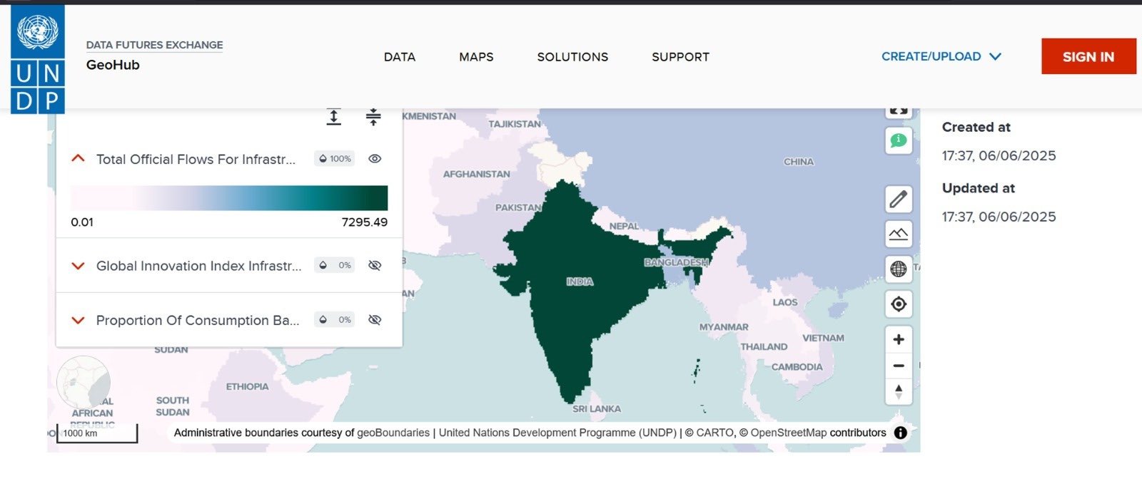

Over recent years, UN maps have frequently misrepresented India’s internationally recognized boundaries, especially by omitting regions such as Arunachal Pradesh (67,522 sq. km), Jammu & Kashmir (185,947 sq. km), including Aksai Chin (30,425 sq. km)
These territories are often depicted as “sovereignty unsettled”, which results in maps showing a truncated version of India, missing both its northern crown and eastern extension. These inconsistencies have surfaced across various UN agencies and platforms, including datasets related to trade, environment, development, and sustainable goals, raising serious questions about the intent and transparency behind such depictions.

Notably, no official explanation has been provided in UN records or public communications, leaving observers to question whether these changes are influenced by external pressures, particularly from China.
WHO’s Role in Reinforcing Disputed Depictions
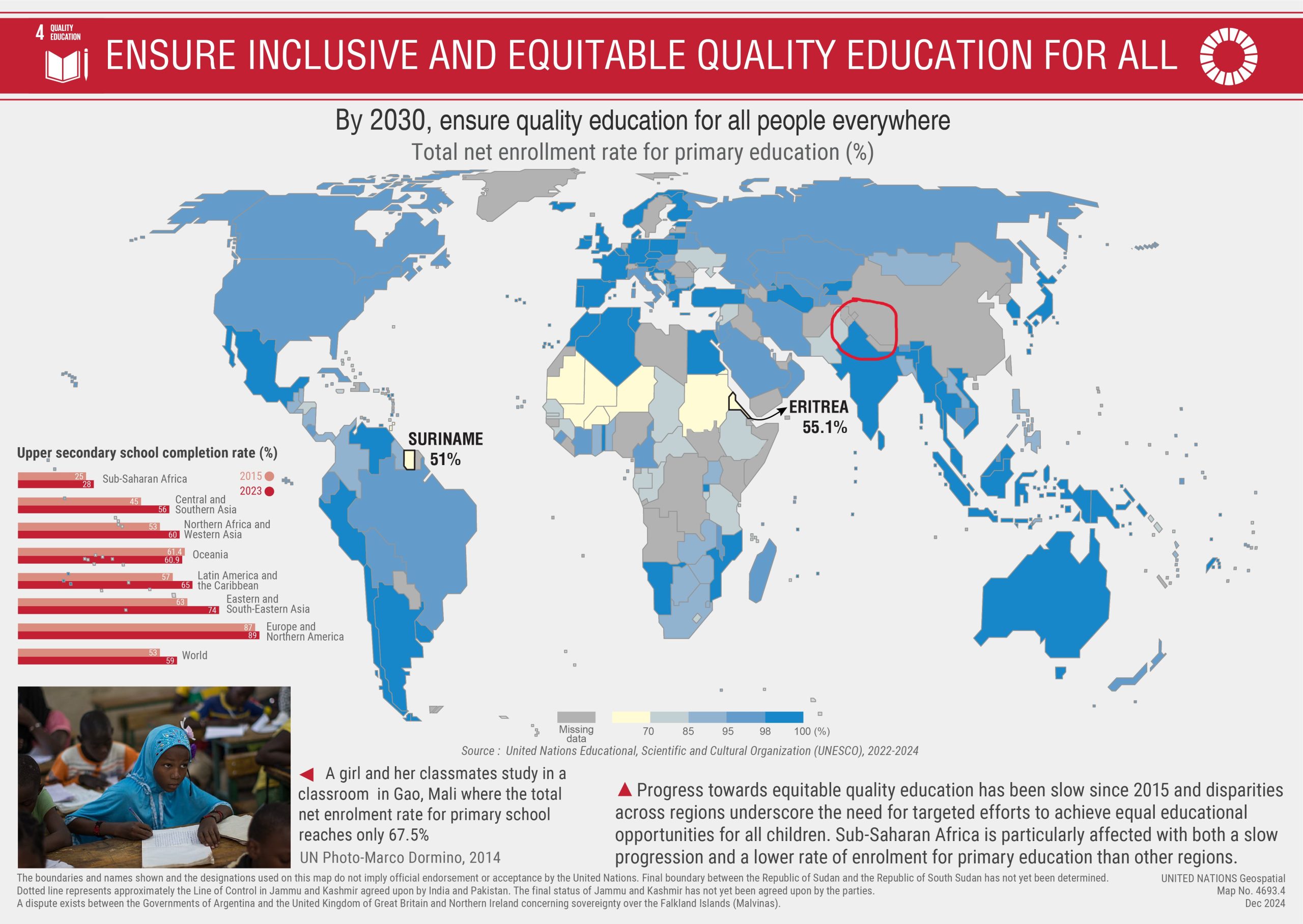
In January 2021, during a COVID-19 data presentation, the World Health Organization (WHO) drew criticism by coloring Jammu & Kashmir and Ladakh in grey, separate from the navy blue used for the rest of India. Though WHO claimed adherence to UN cartographic conventions, the visual segregation of these Union Territories sparked concern.

(Image Credit: OpIndia)
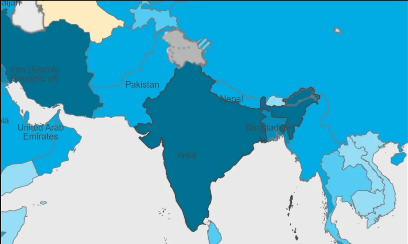
Further scrutiny of WHO’s maps reveals deeper issues. Arunachal Pradesh, although shaded in blue, was shown as a distinct landmass (polygon), implying separation. In a “Detailed Boundary Disputed Areas” map, Arunachal’s entire boundary is dotted, indicating territorial dispute. Another map depicts Arunachal’s internal border with Assam as contested a recent and alarming development, especially as China continues to rename locations in Arunachal as part of its “South Tibet“ claims.
Meanwhile, WHO’s administrative boundary (ADMO) map does reflect India’s claims, yet still marks PoK and Aksai Chin separately, creating inconsistencies within WHO’s own mapping systems.
UN-Wide Discrepancies Across Platforms
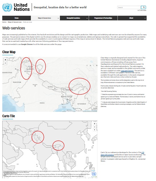
The issue isn’t limited to WHO. The UN Geospatial Information Section, which offers a service called ‘Clear Map’ for internal use, includes maps where:
- J&K is outlined with dotted lines, visually detaching it from India
- Arunachal Pradesh appears isolated, resembling neighboring sovereign nations like Nepal or Bhutan
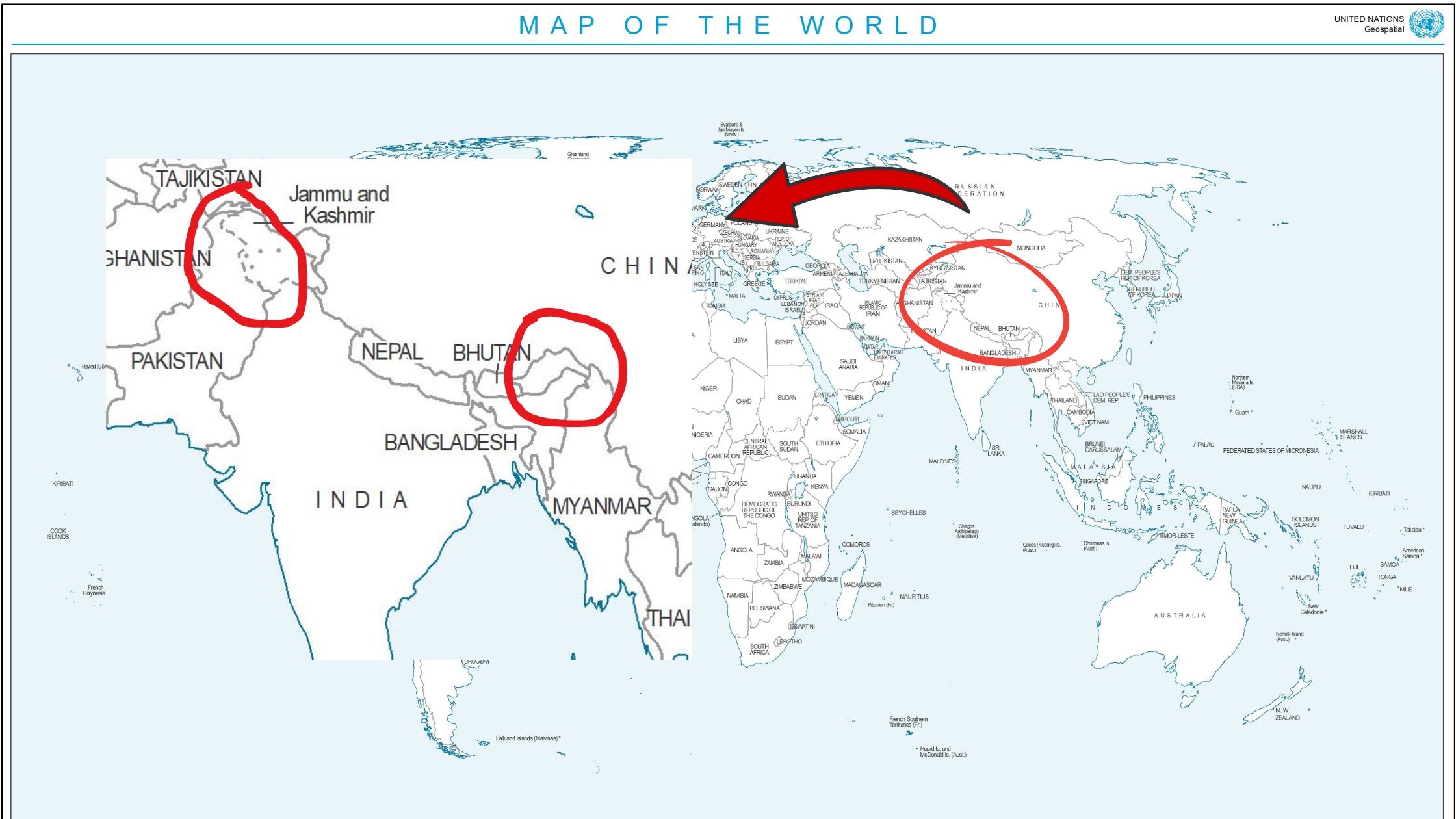

Even the interactive Carto Tile map omits labeling for Arunachal, further implying ambiguous sovereignty. While disclaimers exist regarding the Line of Control (LoC) in J&K, no such caveats accompany the disputed borders of Arunachal, leading to uneven representation.

Several UN-affiliated platforms mirror this inconsistency, for example, the FAO uses outdated maps, while the Global Administrative Areas Database (GADM) v4.1 depicts all of J&K and Arunachal as separate from India, a significant shift from previous versions, which excluded only PoK and Aksai Chin. Similarly, the UNCTAD database presents no data for Arunachal and J&K when hovered over, as if these territories were not part of India. While it includes a disclaimer, this only reinforces the perception of intentional segmentation.
Agencies like UNFCCC and UNEP largely rely on the visual framework set by the UN Geospatial Division, but variations remain in how they present Arunachal Pradesh. On the UN’s Sustainable Development portal, India is shown in yellow, but Arunachal and J&K are marked with dotted boundaries, symbolizing dispute.
Why This Matters: More Than Just Lines on a Map
Though the UN insists its maps are neutral and includes a standard disclaimer — “Boundaries and names shown and designations used on this map do not imply official endorsement or acceptance by the United Nations” the influence of visual representation is far-reaching.
Incorrect maps do not remain confined to UN databases:
- They inform diplomatic briefings, academic curricula, and international development strategies
- They misguide global opinion, distort legal narratives, and undermine India’s territorial claims
- They impact aid distribution, misrepresent populations, and isolate residents of the “disputed” areas
- Such cartographic distortions benefit aggressive claimants like China and weaken trust in the UN’s credibility as a neutral global body.
A Call for Accountability
In the face of escalating geopolitical tensions and rising cartographic hostilities, it is imperative that the United Nations adhere to the principles of neutrality and consistency in territorial representation. The upcoming 2025 sessions of the UN Global Geospatial Knowledge and Innovation Centre and the UN Committee of Experts on Global Geospatial Information Management (UN-GGIM) in August present an opportunity to re-evaluate these inconsistencies.
As the global custodian of geospatial standards, the UN bears a unique responsibility to ensure its mapping practices respect the administrative realities of member states. Anything less not only compromises its credibility but also amplifies the very disputes it is meant to mediate.
Why are UN maps distorting India's boundaries?
UN agencies have repeatedly misrepresented India’s International borders, excluding most of Arunachal Pradesh and J&K, some databases marking them as “sovereignty unsettled.” Alarmingly, the World Health Organization has shifted the… pic.twitter.com/B8cQrIVesp
— Dr Y Nithiyanandam (@prof_nithiya) July 18, 2025
Subscribe to our channels on Telegram, WhatsApp, and Instagram and get the best stories of the day delivered to you personally.