


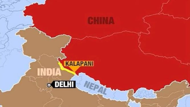
On Wednesday, the Government of Nepal released new political maps that claimed the Indian territories of Kalapani, Limpiyadhura and Lipulekh as its own. The new controversial map was launched by Minister of Land Management Padma Kumari Aryal.
Ministry of External Affairs spokesperson Anurag Srivastava said in a statement that the unilateral act of Kathmandu was not based on historical facts and evidence and went against the bilateral understanding of resolving the border issues through diplomatic routes. He urged Kathmandu to opt the diplomatic route to settle the border dispute.
Nepal’s President Bidhya Devi Bhandari earlier this month while addressing a joint session of the Parliament had said that new maps of the country would be published that will show all areas it considers its own.
Bhandari had said, “Limpiyadhura, Lipulekh and Kalapani region are Nepal’s territory and concrete diplomatic efforts will be taken towards reclaiming these territories. An official map of Nepal will be published accordingly incorporating all the territories of Nepal.”
The release of the new map comes after the recent road inauguration by India’s Defence Minister Rajnath Singh from Dharchula to Lipulekh that would serve as a simpler route for Kailash-Mansoravar pligrims.
Nepal Foreign Minister Gwali had summoned the Indian envoy to Nepal Vinay Mohan Kwatra to raise the matter. However, the Government of India refuted Nepal’s concerns saying that the road going through Uttarakhand’s Pithoragarh district lies completely within the territory of India.